

Introduction
We were recently asked what the difference is between a panoramic and an orthomosaic view of a project. We thought it was a great question, so we put together an answer for you here:
What is an orthomosaic?
An orthomosaic is a mosaic of aerial images that has been geometrically corrected and then colorized. The process of creating an orthomosaic involves taking many photos from multiple locations and combining them into one picture. Orthomosaics are often used in GIS (geographical information system) applications because they provide a way to combine data from multiple sources into one visual representation.
A georeferenced orthophoto is an orthophotograph that has been geolocated to exactly match its real-world coordinates, whereas an un-georeferenced orthophoto might only have been positioned in relation to other objects within the photograph’s frame of reference (such as buildings).
How can you create an orthomosaic?
- A mosaic is a collection of images that together create a larger image.
- An orthomosaic is created using photogrammetry, which involves taking aerial photographs and then analyzing them to determine the location of each pixel.
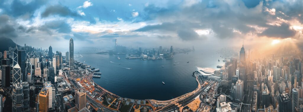
How does a panoramic differ from an orthomosaic?
Panoramic views are created by taking a series of overlapping photos, then stitching them together to form a single image. This method is better suited to capturing landscapes, as it requires less processing power than creating an orthomosaic.
How can you use these views in construction?
Orthomosaic views are used for creating 3D models of a project. These models can be used to inspect the progress of a site, see what needs to be done next, and plan the next steps in construction. Orthomosaic views also allow you to create textured 3D models that can be used as visual aids in presentations or reports. It is required if you wish to take accurate measures of the objects, such as the distance from point A to point B, or the dimension of a structure.
Panoramic views typically have a vantage point, and allows the observer to quickly eyeball the current condition or progress of a site. However, due to the tilts and distortions that come with panoramic views, it’s not advisable to use them for accurate measurements.
In the construction industry, it’s more important than ever to have accurate information on a project
In today’s construction industry, it’s more important than ever to have accurate information on a project before moving forward with construction. A 3D orthomosaic of the surface can be used to determine if there are any potential hazards or unforeseen issues. A 3D image of a site can be used as an accurate map of where things are located and how they’re positioned. Once you have an orthomosaic map in place, you can make sure that everything fits together properly and figure out where problems may arise during construction or when the building is done being built.
Airpland is an easy-to-use tool to help you manage your drone flight and aerial data.
Airpland is the go-to platform for you to manage your drone flights and aerial photos and modelling. It saves you lots of time and energy jumping between different systems and platforms, and makes it extremely easy to manage and share aerial data, models, photos with your clients and colleagues in one place.
We hope this article has helped you understand the differences between panoramic and orthomosaic views. If you are interested in learning more about how drones can help your construction site, please contact us today on hello@operva.ai or visit operva.ai!