
Introduction
If you work in construction, you probably use many tools every day to complete your projects. But there’s one tool you might not have on your belt: reality capture software. Unlike hammers or saws, reality capture software doesn’t help you build anything; instead, it helps you learn about what has already been built. In particular, digital models created from laser scanning and other technologies can provide valuable insights into the objects around us, informing better decisions and improving project outcomes. This can have tremendous implications on projects, saving companies potentially hundreds of thousands’ or millions of dollars in time and cost savings. Reality capture is a powerful tool that is becoming more accessible all the time—and when used correctly, it can transform the way we build. So how does it work?
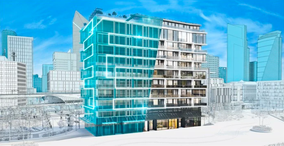
Reality capture is the process of creating digital models from real-life objects.
Reality capture is the process of creating a digitally-based representation of real-world objects. With the rise in popularity of virtual reality and augmented reality, there are now many ways to use this data to create digital models.
In construction, this technology can be used to create accurate models of buildings or other structures before they’re built. These models can be used as virtual walkthroughs for clients, providing them with a better idea about what their final building will look like. They can also help architects and builders make better decisions about how design elements should fit together at different stages in construction—helpful for making sure that everything fits properly when it’s time to install windows or siding!
Three popular reality capture technologies are photogrammetry, laser scanning, and LiDAR.
Reality capture can be divided into three main categories: photogrammetry, laser scanning, and LiDAR.
Photogrammetry is the process of taking photos of a subject and using software to reconstruct a 3D model. You may have seen this in action when you get your passport photo taken at the post office—the photographer uses special software to enhance and alter your image before printing it out on glossy paper.
Laser scanning works similarly to photogrammetry but with lasers instead of cameras; you fire a laser at your subject from different angles (usually 360°) and measure how much light is reflected back off its surface for each angle as well as its color within that specific area. This gives us our first point cloud which we can then use as input for computer vision algorithms that extract features such as lines or points on surfaces like windows or doors so we can identify them later on during building analysis processes (e.g., room layout).
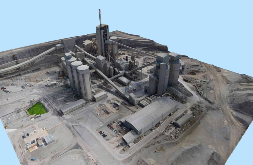
There are many different ways to use reality capture data on construction projects.
There are many different ways to use reality capture data on construction projects.
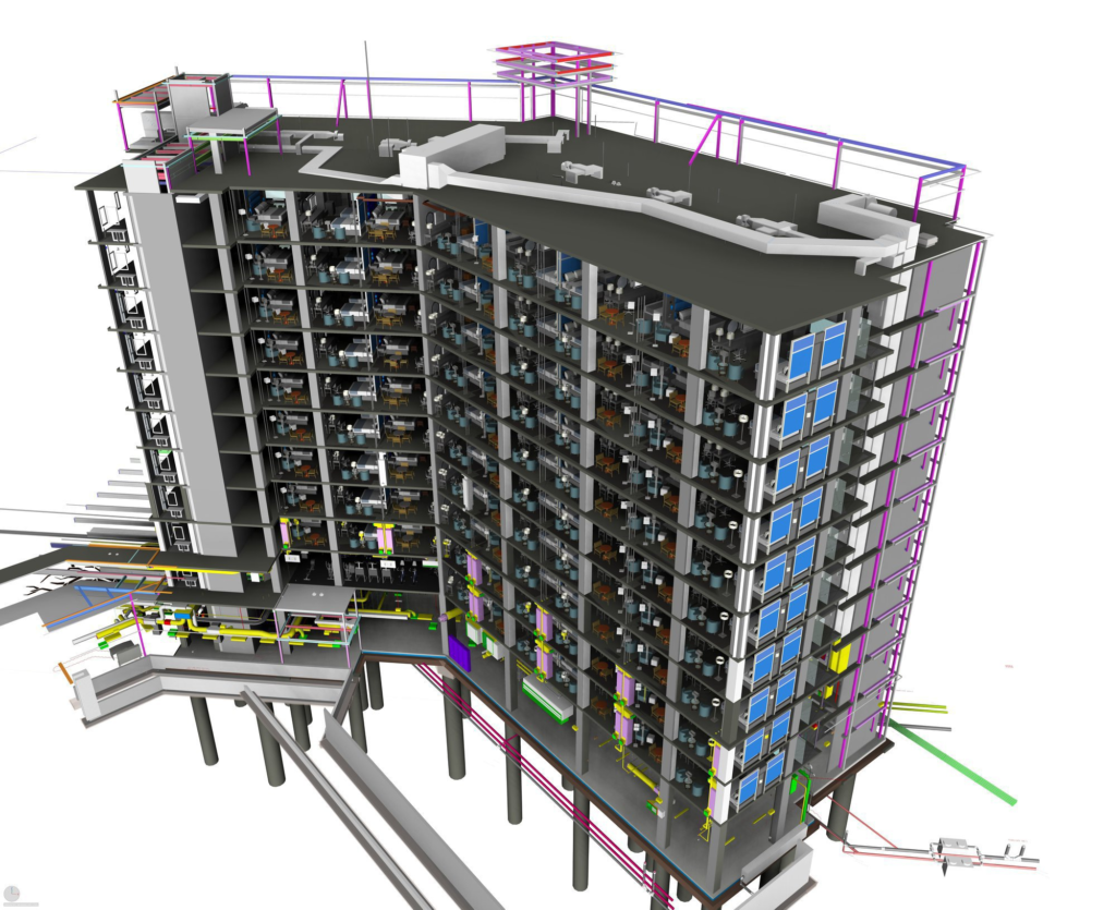
You can create a digital twin of the building, which is essentially an exact replica of your building in simulation software like Revit or Navisworks. This allows you to perform virtual walkthroughs and see exactly how everything will fit together before you start construction.
You can also create a Building Information Model (BIM) for the project. This gives you access to incredibly detailed information about every aspect of your project—from wall thicknesses and pipe sizes to material costs and labor requirements—all in one place. It allows everyone involved with the project (including subcontractors) to see all relevant information at once; this reduces communication errors, improves efficiency, minimizes waste, and increases overall quality control during construction activities such as painting or plumbing work.
Another way that reality capture data can improve construction projects is by creating photorealistic models of spaces before they’re built so that clients get an accurate sense of what their completed space will look like without having to wait until after completion! In fact, this process has become so popular among clients looking for home decor inspiration that there exists entire websites dedicated solely towards showcasing these types.
Reality capture can help you make better decisions and visualize project progress.
Reality capture is widely considered to be the most effective way to manage a project.
If you’re new to construction, or if you’re a seasoned veteran of the industry, there’s one thing that is clear: reality capture can help you make better decisions and visualize project progress.
The benefits of reality capture include re-use of data across projects, reduce time and cost of design, better decision making and project management, better communication with stakeholders (both internal and external), increased safety for workers onsite through improved quality control measures, stakeholder engagement through collaboration tools like virtual reality (VR) or augmented reality (AR) headsets in addition to real-time updates via mobile devices such as tablets or smartphones; all these tools enable users access any time anywhere so they can be involved with what’s happening on site right now rather than waiting until something goes wrong before they get involved again! Reality Capture can also help improve delivery because it provides an accurate snapshot that enables everyone involved in creating your dream home together!
Choosing the right hardware and software can help you optimise your project requirements.
Depending on your project requirements, the solution you need can vary drastically, from the grade to frequency (with a direct implication on cost!). It’s not the higher spec, the better, nor the cheaper, the better. It’s crucial for key decision makers to really understand their needs and choose the right solution.
For example, you don’t necessarily need Laser Scanning for each single scan of your project site, if all you need is to water the progress of the exteriors, you could likely rely on drone photogrammetry. The flight the drones, you could either outsource it to a drone operator in your local area, or invest on an in-house pilot and a drone. It is worthwhile pointing out that because 3D photogrammetry is not consistently used in the industry, most people only use drones for aerial photography. The moment you cross into photogrammetry arena, the requirements on input data suddenly become much more stringent and therefore require the drone pilots to possess extensive experiences as well as some photogrammetry data modelling experiences.
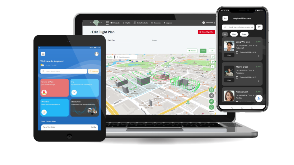
AirPland is an example of a solution that makes photogrammetry fairly easily, regardless of the user expertise (that is, you will definitely get better results if you have more experiences.) The product is also continuing to innovate to make more functionalities available to help pilots, architects, project managers, engineers, BIM managers alike to unlock the full potential of reality capture. Find out more at operva.ai.
Conclusion
Reality capture is a powerful tool, but only if you know how to use it. You don’t need to be an expert in the technologies involved, or even understand all the ins and outs of your data. But you do need to understand how reality capture can help you make better decisions and visualize project progress so that you can communicate clearly with your team members and stakeholders.