

Facade Inspection and Digital Twin Platform App
AIRPLAND Software Suite is a cloud-based solution that enables participants in the built environment value chain to execute their duties with higher precision and efficiency, and to work together..
ANALYTICS, REPORTS, MONITORING ON A SINGLE PLATFORM
ABOUT AIRPLAND
AIRPLAND is a suite of software products developed by Operva AI that aims to bring advanced digital technology to high value asset industries including infrastructure, construction, and facilities management. The AIRPLAND software suite currently contains:
AIRPLAND Flight, a mobile app for drone flight management,
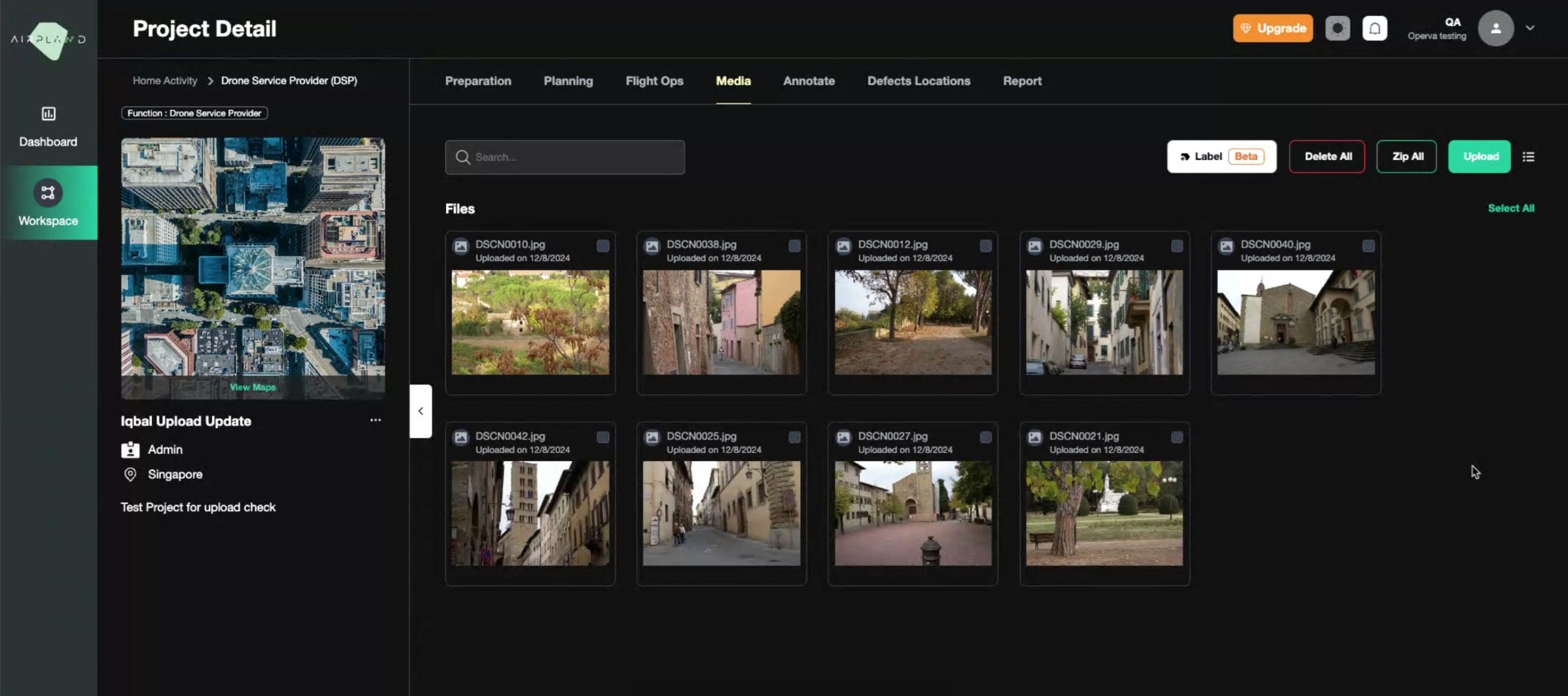
AIRPLAND Inspect, a one-stop facade inspection platform that automates your facade inspection practices,
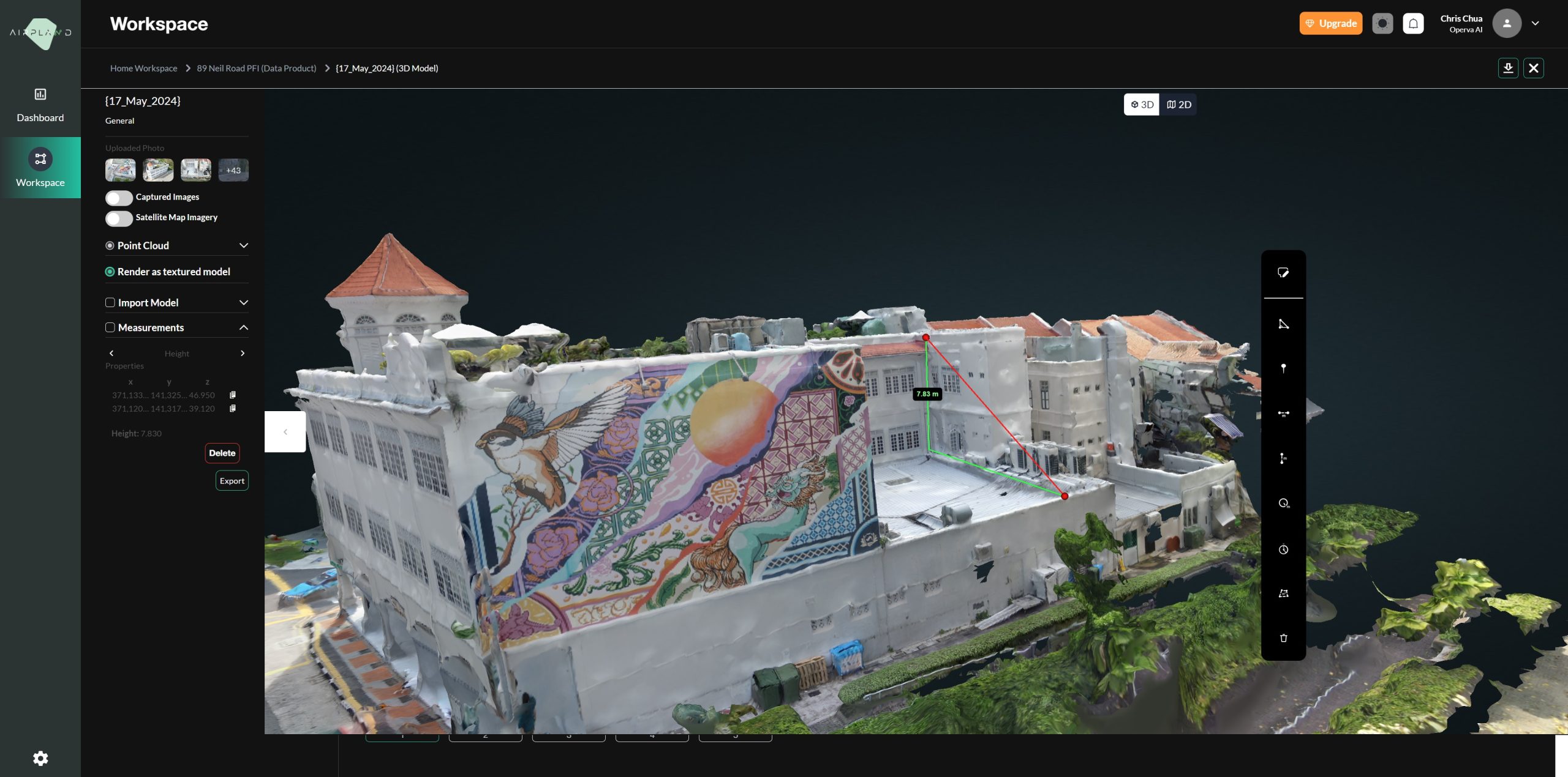
AIRPLAND Construct, a reality capture software that stitches images to build 3D models and 2D orthophotos for further analysis.
Using the software is intuitive:

Create projects and flight plans
Create a profile with us. It is free, quick and simple. Then create a project by following the prompts in the portal, or start drawing flight plans on the map directly.

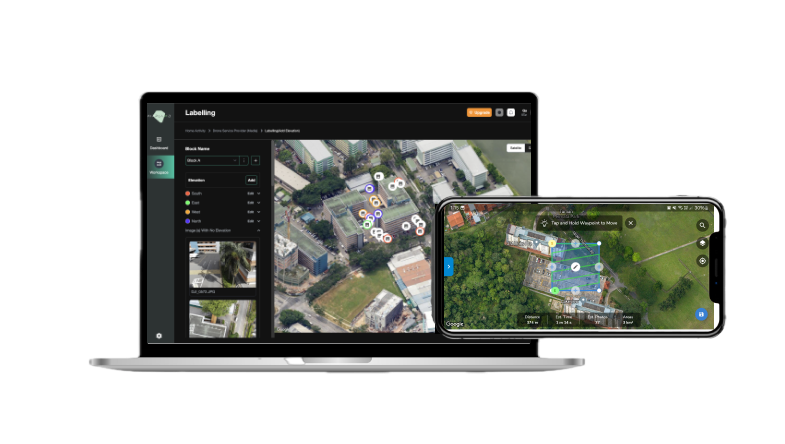
Fly with the AIRPLAND Flight mobile app
From airspace and weather information to auto fly functionality, the Airpland app ensures you get the drone data you need.

Build 3D models with AIRPLAND Construct web solution
Auto upload aerial images from Airpland app to our cloud platform for process data into orthomosaics, digital surface models, and contour maps.

Analyze data on AIRPLAND Inspect web solution
Perform analysis on the interactive map viewer with measurement tools for distance and area. Exportable 2D and 3D data products give you the flexibility to share across.
Your flight plans, your way.
Start Flying
The free AIRPLAND Flight mobile app takes your drone flight to new heights. It helps you keep projects moving from anywhere, so you can stay focused on what matters — all from your console, phone or tablet.


Start Inspecting Better
AIRPLAND Inspect is a software specializing in infrastructure inspection.
- Robust inspection process workflow.
- Images are well-organized with defects tagged to geolocation.
- Uses AI to assist in the identification of defects.
- Uses AI in auto privacy masking.
- Auto-generation of inspection report based on TR78 requirements.
- Ease of information sharing, review, and collaboration between users.
- One stop system for documents, images, analytics, reports.
- Supports in the compliance process, hassle-free user experience.
Start Capturing Reality
AIRPLAND Construct is a software focusing on construction progress monitoring.
- 3D Model via photogrammetry, with high accuracy & short processing time.
- 2D drawings overlay feature to facilitate alignment.
- Enhanced GCP (ground control points) via A.I. detection.
- Taking of volumetric/area/distance measurements of site.
- Commenting and annotating within software.
- Site progress can be reviewed anytime on-demand with drone-based solution.
- Easy tracking of project progress and KPIs with dashboards.
- Option to pair up with Airpland Flight mobile app for automated flight planning.

All the Features You Need
- Unlimited maps
- Unlimited images upload
- Plan flights in 2D/3D
- Check weather and airspace
- Schedule flight plans
- Explore and share maps
- Project management
- Resource management
- UTM support
- Team and user management
- API integrations
- Insurance on-demand
hello@operva.ai
Address
60 Paya Lebar Road, #06-28 Paya Lebar Square, Singapore 409051