
All New One-stop Facade Inspection Platform
AIRPLAND Inspection is a cloud-based platform that Automate and supercharge facade inspection. It connects Professional Engineers, Drone Pilots, Building Owners etc to complete the inspection seamlessly.
ANALYTICS, REPORTS, PROGRESS ON 1 AI PLATFORM
ABOUT AIRPLAND
AIRPLAND is a suite of software products developed by Operva AI that aims to bring advanced digital technology to high value asset industries such as buildings and construction. The AIRPLAND software suite currently contains AIRPLAND Flight, a mobile app for drone flight management.
AIRPLAND Inspection will soon join the family. AIRPLAND Inspection is a one-stop facade inspection platform that houses ANALYTICS, REPORTS, PROGRESS MONITORING altogether. It will automate and supercharge your facade inspection practices. Join the waitlist now.
Here’s how it works:

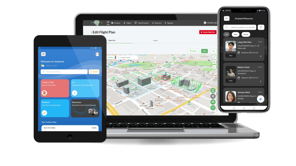
Create projects and flight plans
Create a profile with us. It is free, quick and simple. Then create a project by following the prompts in the portal, or start drawing flight plans on the map directly.

Fly with the AIRPLAND Flight app
From airspace and weather information to auto fly functionality, the Airpland app ensures you get the drone data you need.

Upload images for process
Auto upload aerial images from Airpland app to our cloud platform for process data into orthomosaics, digital surface models, and contour maps.

Analyse data on AIRPLAND Inspection web portal
Perform analysis on the interactive map viewer with measurement tools for distance and area. Exportable 2D and 3D data products give you the flexibility to share across.
Your flight plans, your way.

All the Features You Need
- Unlimited maps
- Unlimited images upload
- Plan flights in 2D/3D
- Check weather and airspace
- Schedule flight plans
- Explore and share maps
- Project management
- Resource management
- UTM support
- Team and user management
- API integrations
- Insurance on-demand
Start Flying Drone For Free
The free AIRPLAND Flight mobile app takes your drone flight to new heights. It helps you keep projects moving from anywhere, so you can stay focused on what matters — all from your console, phone or tablet.